Route Filmstrip & Description
Validated by Fieldfare
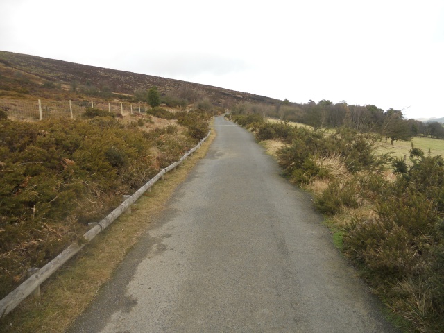
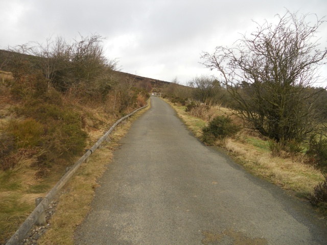
The Stiperstones National Nature Reserve is located within the Shropshire Hills Area of Outstanding Beauty. The site is a treasure trove of nationally significant geology and wildlife: jagged quartzite rocks dominate the skyline. Curlew, skylark and buzzard can be seen (if not heard!) and in late summer the hills are covered in a soft haze of flowering bilberry, heather and gorse...The 500m all ability trail starts at the main car park (Grid Reference SO369976). The needs of wheelchair users and people with visually impaired have been well-considered here, as plenty of rest areas and a tapping-rail have been provided along the course of the path. Visitors should note that the condition of the path deteriorates somewhat after the end of the all-ability trail. The site is very exposed, so be warned: the weather is often extreme! Toilet and refreshment facilities can be found in local villages, including disabled toilets in the nearby village of Snailbeach.
Surveyed by: , February 2011
(Winter)
Accessibility Rating: 2
Distance: 0.5 km
Car Park: The car park is situated at the start of the trail and has three spaces reserved for visitors with disabilities.
Steps: No
Barriers: Two gates were encountered along the route. These were found to be accessible to wheelchairs and had been installed with easy-to-use latches.
Toilets: No

There are three disabled parking bays in the car park which are located next to the site entrance. The parking area is flat and well-surfaced.
The wicket gate is fitted with a trombone latch which allows the gate to be opened at different heights. The gate opens in both directions which also makes it easier to operate.
A rail has been installed along the left hand course of the path to provide assistance to visitors with a visual impairment.
Stone cobbles have been set into the path to create 'rumble strips'. These provide a tactile cue and enable visually impaired visitors with a means to locate seating areas.
The path ascends very gently over the next 100 metres. Over this distance the gradient averaged about 3%.
Sections of post-and-rail have been installed along the course of the path. These create perches to rest, lean against and somewhere to stop and admire the views.
There are several benches along the course of the path with hard surfacing around the sides, making it easy for wheelchair users to sit adjacent to their family and friends. Rumble strips assist visually impaired visitors to determine their location.
Perches are located at points between the benches. There are many opportunities to stop and rest along the route.
At this point there is a tap rail on the right-hand side of the path. This helps to guide visually impaired visitors towards the kissing gate.
Another interpretation board is located next to the gated area. This contains a description of the past and present management of the Stiperstones, as well as some of the flora and fauna you are likely to see here.
The width of the kissing gate enclosure is 1.8 metres. This allows adequate space for wheelchairs, pushchairs and mobility vehicles.
Another perch located just after the kissing-gate. A section of post and rail (as seen in the background) 
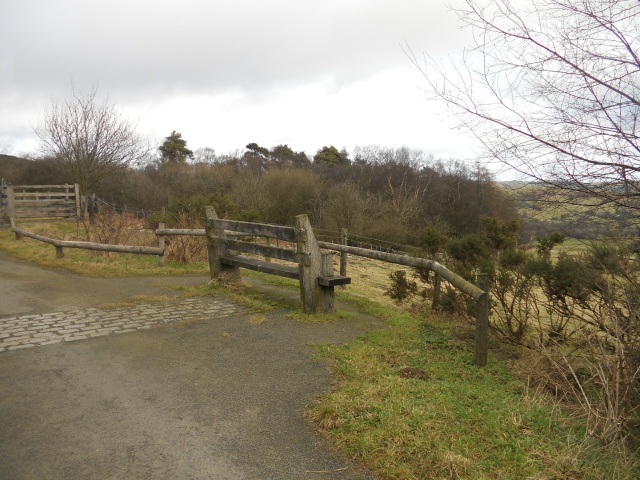
provides a barrier to the ditch created by the fallen tree.
The bench and the end of the tap rail, as seen in the background, signify the end of the all-ability path. However, visitors may wish to continue further, as from here the path is well surfaced for another 300m or so (note that a more sustained, yet gentle uphill gradient is involved with no further rest areas). After this, the path surface slowly gives way and becomes more uneven.
The Stiperstones - All Ability Trail Phototrail
Map Markers
The route is shown as a red line. You can show or hide the types of points indicated on the map using the checkboxes below.
Show All Trail Points | Show No Trail Points | Show Summary
Accessibility Info | Amenities Info | Facilities Info | Features Info | Way Finding Info | ||||||||||||||||||||||||||||||||||||||||||||||||||||||||||||||||||||||||||||||||||||||||||||||||||||||||||
---|---|---|---|---|---|---|---|---|---|---|---|---|---|---|---|---|---|---|---|---|---|---|---|---|---|---|---|---|---|---|---|---|---|---|---|---|---|---|---|---|---|---|---|---|---|---|---|---|---|---|---|---|---|---|---|---|---|---|---|---|---|---|---|---|---|---|---|---|---|---|---|---|---|---|---|---|---|---|---|---|---|---|---|---|---|---|---|---|---|---|---|---|---|---|---|---|---|---|---|---|---|---|---|---|---|---|---|---|---|---|
|
|
|
|
|
A map of the route is shown above -
- click on any marker point to view a photograph and the description of that point
- to zoom in or out use the navigation tool on the top-left of the map
- click and drag to change the centre of the map
- you can change to map/terrain/satellite/hybrid (satellite + map) views using the control on the top-right of the map
Route directions are shown below the map.
- Click on any marker icon in this list to highlight that point on the map and show a photo of that spot.
Got something to say about this Phototrail? Let us know!
Vertical Profile
This is an approximate vertical profile with samples taken at 100m intervals along the trail.
